CASE STUDY DESCRIPTION
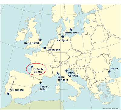
The La Faute-sur-Mer case study site is located on the Atlantic Coast, in the Bay of Biscay, roughly half way between Spain and Brittany, in the department of Vendee, 20 km north from La Rochelle. Two big islands separated by several embayments, which correspond to drown river valley segments, characterize this stretch of coastline.
The local tidal regime is semi-diurnal and ranges from less than 2m during neaps, to more than 6m during springs. The wave regime is energetic at the entrance of the estuaries, where winter storms cam yield wave height larger than 8 m, but wave energy is rapidly dissipated by refraction and bottom friction in the inner part of the estuaries where the study area is located. The side of the peninsula exposed to the ocean is naturally protected by a dune with a rear back dune lagoon that acts as a buffer in case of a storm surge.
Coast and hazards
La Faute-sur-Mer is a small touristic village of roughly a 1,000 inhabitants during the winter season. Very popular, the village may attract more than 20,000 tourists per day during the summer season. Built on a sandy spit between the ocean and the Lay River, 75% of the village’s surrounding territory is characterized as natural protected area and has been preserved from big constructions along the seaside. There is a specific feature of the La Faute-sur-Mer in that there is no long-term erosion. Naturally, during storm conditions, the sand barrier and the beach experience erosion, but the sand dune has a great naturally protective effect. The sandspit is growing and the territory of La Faute-sur-Mer is extending toward the south and the sea. The beach is extending, illustrated by the fact that 240 m of dune have been gained over the sea over the last 50 years.
Despite the previous storms that affected this area, it seems that the risk has been forgotten in favor of unbridled urban planning. This may be due to a small decrease of events since 1940, but since the total number of resident can reach 20 000 during the summer period, the town faces a serious demographic pressure that could have lead to a loss of risk memory. Moreover, new inhabitants were not aware and not prepared for any potential flood since they mainly came from other locations. The devastating impacts of the storm surge associated with storm Xynthia, combined with the high spring tide, brought in light the great risk in which the area is under as well as the significant resources that are necessary in order to deal adequately with similar incidents. As most of the residential area of the village is still considered hazardous, the implementation of RISC-KIT methodology can provide important benefits for the local community offering at the same time a Case Study with very strong socio-economic impact component for the project.
Predictability
The storm was forecast accurately by Météo-France, the French weather forecasting service, and hourly-mean storm winds from SW reached 25 m.s-1 and maximum gusts 40 m.s-1. Four departments had been highlighted as having a ‘‘red vigilance’’ by Saturday afternoon. However, the storm surge was estimated by Météo-France to about 1.0 m while, in reality, it exceeded 1.6 m in La Rochelle and probably slightly more in La Faute-sur-Mer (Bertin et al., 2012; Bertin et al. 2015). This exceptional storm surge peaked at the same time as a high spring tide, which caused the total water level to reach 8.0 m with respect to marine charts datum, a value unpublished according to the available water level data. This extreme water level was higher than the crest of many dikes and natural barrier and leads to the massive flooding of the central part of the Bay of Biscay (departments of Vendée and Charente-Maritime), including La Faute-sur-Mer, where 27 people tragically died. This exceptional storm surge was explained by Bertin et al. (2015) by the development of a particular sea-state, characterized by young and steep waves, which strongly enhanced the wind contribution. This particular sea-state was explained by the particular track of Xynthia from SW to NE, which reduced the fetch to a few hundred km in the Bay of Biscay, compared to several thousand under classical storm tracks. The correct prediction of this phenomenon implies the use of a high spatial resolution as well a full coupling between a hydrodynamic and a wave model, which were not available at Météo France at the time of Xynthia. The return period of the associated with the storm surge was estimated to more than 50 yr by Hamdi et al. (2015) while that of the total water level was estimated to about 300 yr by Bulteau et al. (2015). Although the analysis of historical archives revealed that other storms induced significant flooding over the past centuries (Breilh et al., 2014), Xynthia was well an exceptional event.
Historical flood events
From what we know, more than 30 coastal floods have occurred during the last 500 years (see table below). The latest storm Xynthia resulted in the deaths of 47 people including 41 related to coastal flooding and 29 for the town of our case study site: La Faute sur Mer. This death toll was the largest ever recorded for this type of event in France (Garnier 2010). Xynthia appeared in the centre of the Atlantic Ocean at the latitude of the Tropic of Cancer and then shifted to the north-west following an atypical trajectory.
|
Year |
Storm, floods |
|
1738 |
floods in the neighboring towns, since la Faute sur Mer did not exist yet. |
|
1740 |
floods in the neighboring towns, since la Faute sur Mer did not exist yet. |
|
1788 |
floods in the neighboring towns, since la Faute sur Mer did not exist yet. |
|
1850 |
tsunami documented in the neighboring towns. |
|
1882 |
Floods in La Faute sur Mer. Overtopping on dikes. |
|
1906 |
Floods in La Faute sur Mer. Overtopping on dikes. |
|
1928 |
Surge and floods in La Faute sur Mer, the village become an island for a couple of days. |
|
1930 |
Storm, The dike of la Faute is damaged on 800 m long. |
|
1937 |
Dikes protecting La-Faute-sur-Mer, l’Aiguillon and Triaize are broken. |
|
1940 |
Breaks of Triaizé dike, 3000 ha of cultivated field are flooded. |
|
1999 |
Breaks of a dike protecting l’Aiguillon, although the tide coefficient was only 77, 30 ha of cultivated field are flooded. |
|
2010 |
Massive floods over La-Faute-sur-Mer, l’Aiguillon and the main part of cultivated fields surrounding the towns by the storm Xynthia |
This information has been extracted from the RISC-KIT "Review report of key challenges and lessons learned from historical extreme hydro-meteorological events".
The datasets on storms are available for download from the project’s historical storm database.
REferences
Bertin, X., Bruneau, N., Breilh, J.F., Fortunato, A.B., Karpytchev, M., 2012. Importance of wave age and resonance in storm surges: the case Xynthia, Bay of Biscay. Ocean Modelling 42, 16–30.
Bertin, X., Li, K. and Roland et Bidlot, J.R., 2015. The contribution of short waves in storm surges: two recent examples in the central part of the Bay of Biscay. Continental Shelf Research 96, 1-15.
Breilh, J.F., Bertin, X., Chaumillon, E., Giloy, N. and Sauzeau, T, 2014. How frequent is storm-induced flooding in the central part of the Bay of Biscay ? Global and Planetary Change 122, 161-175.
Bulteau, T., Idier, D., Lambert, J. and Garcin, M., 2015. How historical information can improve estimation and prediction of extreme coastal water levels: application to the Xynthia event at La Rochelle (France). Nat. Hazards Earth Syst. Sci., 15, 1135–1147.
Hamdi, Y., Bardet, L., Duluc, C.-M., Rebour, V., 2015. Use of historical information in extreme-surge frequency estimation: The case of marine flooding on the La Rochelle site in France. Natural Hazards and Earth System Sciences, 15 (7), 1515-1531.